

Directions to Upper Campus from Cape Town
The University of Cape Town's Groote Schuur Campus is situated on the slopes of Devil's Peak in the suburb of Rondebosch. To reach the upper campus from the city, drive along De Waal Drive or Eastern Boulevard, passing Groote Schuur Hospital on the way.
Just past the hospital the road forks. Take the right-hand fork (M3 to Muizenberg).
Just beyond Mostert's Mill (windmill) on your left, take the Woolsack Drive/University of Cape Town turn-off (Exit 7 Rosebank - M89)
Turn right at the traffic lights on Woolsack Drive and go under the bridge and round a hairpin bend to the northern entrance of the campus.
Please check in at the Visitors' Reception and Information Office opposite the Sports Centre, where directions, campus maps and temporary visitors' parking permits may be obtained.
From the southern suburbs the approach is along Rhodes Drive, where the southern entrance to the campus is clearly signposted from the left lane. There is no information office at this entrance - you may continue on Rhodes Drive past the university to the turn-off to the northern entrance, which will give access to the Information Office as described above.
Click for map:
Floor Plan-Release date (subject to change)
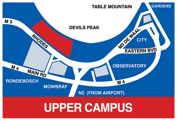
UCT, Upper Campus Map
